
Fail:Austrian Netherlands 1789.svg

Saiz pratonton PNG bagi fail SVG ini: 450 × 456 piksel . Leraian-leraian lain: 237 × 240 piksel | 474 × 480 piksel | 758 × 768 piksel | 1,011 × 1,024 piksel | 2,021 × 2,048 piksel.
Fail asli (Fail SVG, ukuran dasar 450 × 456 piksel, saiz fail: 858 KB)
Ringkasan


.svg)
.svg)
.svg)
.svg)
.svg)


.svg)
.svg)
.svg)


.png)
.png)


.svg)


.svg)

.svg)


.svg)
.svg)
.svg)
.svg)


.svg)
.png)


.svg)


.svg)
.svg)


.svg)


.svg)


.svg)
.svg)
.svg)
.svg)
.svg)
.svg)
.svg)
_cropped.svg)
.svg)
.svg)
.svg)
.svg)
.svg)
.svg)
.svg)
.svg)
.svg)
.svg)
.svg)
.svg)
.svg)
.svg)
.svg)
.svg)
.svg)
.svg)
.svg)
.svg)
.svg)
.svg)
.svg)
.svg)
.svg)
.svg)
.svg)
.svg)
.svg)
.svg)
.svg)
.svg)
.svg)
.svg)
.svg)
.svg)
.svg)
.svg)
.svg)
.svg)
.svg)
.svg)
.svg)
.svg)
.svg)
Perlesenan
Dengan ini, saya selaku pemegang hak cipta karya ini, menerbitkannya di bawah lesen yang berikut:
Fail ini dilesenkan di bawah lesen Pengiktirafan-Perkongsian Serupa 3.0 Tidak Diport Creative Commons.
- Anda bebas:
- untuk berkongsi – untuk menyalin, mengedar dan memindah hasil kerja
- untuk mencampur semula – untuk menyesuaikan karya
- Di bawah syarat berikut:
- pengiktirafan – Anda mesti memberi penghargaan yang berpatutan, bekalkan pautan ke lesen, dan tunjukkan jika perubahan telah dibuat. Anda boleh lakukannya dalam sebarang cara yang munasabah, tetapi bukan dalam sebarang cara yang mencadangkan pemberi lesen mengendors anda atau penggunaan anda.
- perkongsian serupa – Jika anda mengubah, adun semula, atau menokok tambah bahan, anda mesti menyebarkan sumbangan anda di bawah lesen yang sama atau serasi dengan yang asal.
Log muat naik asal
This image is a derivative work of the following images:
- File:Europe_1789.svg licensed with Cc-by-sa-3.0
- 2013-04-14T03:44:26Z Alphathon 450x456 (858577 Bytes) Corrected some errors in northern Italy
- 2013-04-14T01:38:01Z Alphathon 450x456 (853881 Bytes) tweaked again
- 2013-04-14T01:36:10Z Alphathon 450x456 (853881 Bytes) Tweaked Holy Roman Empire border style
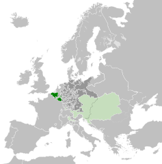
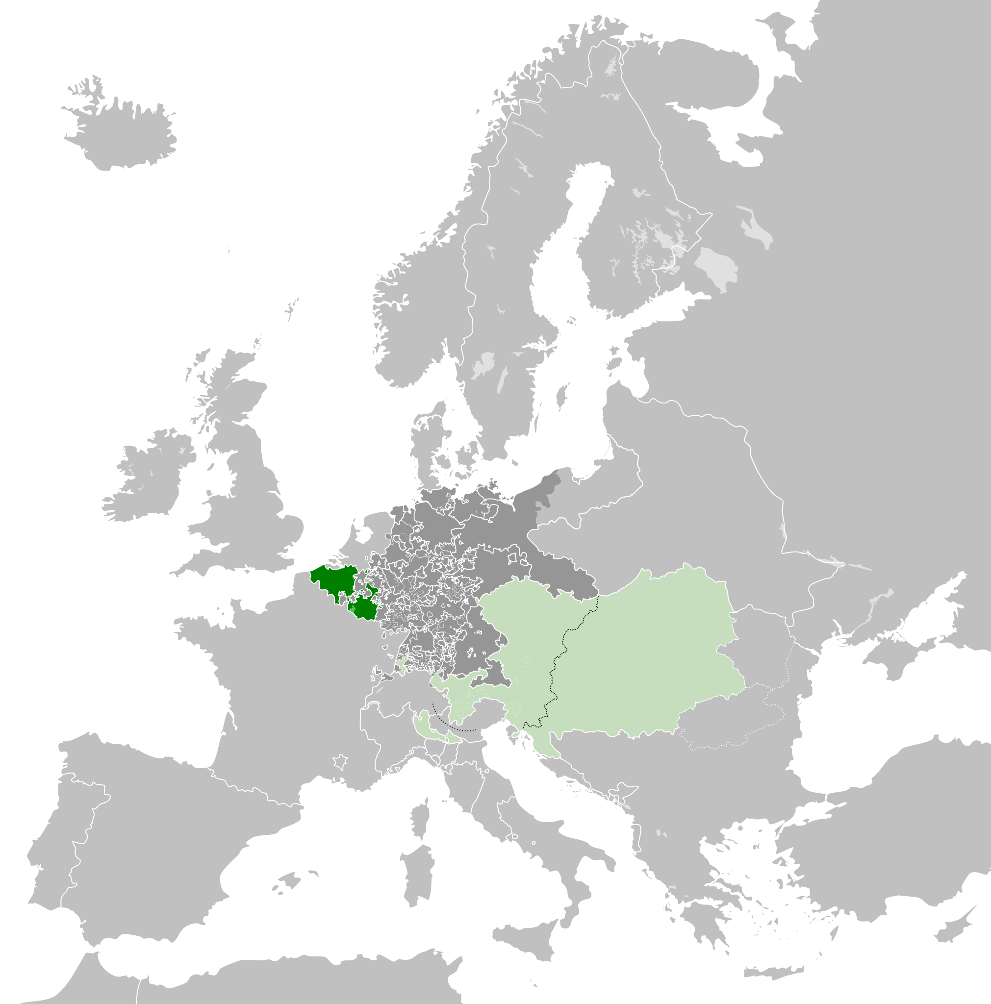
- 2013-04-14T01:33:26Z Alphathon 450x456 (853857 Bytes) == {{int:filedesc}} == {{Information |Description={{en|A blank Map of Europe circa 1789. This map also includes a border for the [[:en:Holy Roman Empire|Holy Roman Empire]]. Since there are so many small German states, they h
Uploaded with derivativeFX
Sejarah fail
Klik pada tarikh/waktu untuk melihat rupa fail tersebut pada waktu itu.
| Tarikh/Waktu | Gambar kenit | Ukuran | Pengguna | Komen | |
|---|---|---|---|---|---|
| semasa | 07:38, 17 Oktober 2021 | | 450 × 456 (858 KB) | Fenn-O-maniC | Wrong file |
| 07:38, 17 Oktober 2021 |  | 450 × 456 (800 KB) | Fenn-O-maniC | Fixed the Russo-Swedish border to match the Treaty of Åbo of 1743 | |
| 07:36, 17 Oktober 2021 |  | 450 × 456 (858 KB) | Fenn-O-maniC | Fixed the Russo-Swedish border to match the Treaty of Åbo of 1743 | |
| 20:34, 18 April 2013 |  | 450 × 456 (878 KB) | Alphathon | Style change | |
| 18:34, 18 April 2013 |  | 450 × 456 (857 KB) | Alphathon | Various fixes | |
| 20:31, 15 April 2013 |  | 450 × 456 (854 KB) | Alphathon | Corrected Scandinavian borders | |
| 23:18, 14 April 2013 |  | 450 × 456 (839 KB) | Alphathon | Changed colour of the remainder of the Habsburg Monarchy | |
| 13:29, 14 April 2013 |  | 450 × 456 (839 KB) | Alphathon | == {{int:filedesc}} == {{Information |Description={{en|A map of the Austrian Netherlands within the Habsburg Monarchy, the Holy Roman Empire and Europe circa 1789.}}{{de|Eine Landkarte die [[:de:Öste... |
Penggunaan fail
Tiada laman yang menggunakan fail ini.
Penggunaan fail sejagat
Fail ini digunakan oleh wiki-wiki lain yang berikut:
- Penggunaan di ar.wikipedia.org
- Penggunaan di ast.wikipedia.org
- Penggunaan di bg.wikipedia.org
- Penggunaan di cs.wikipedia.org
- Penggunaan di en.wikipedia.org
- Penggunaan di eo.wikipedia.org
- Penggunaan di es.wikipedia.org
- Penggunaan di et.wikipedia.org
- Penggunaan di eu.wikipedia.org
- Penggunaan di fa.wikipedia.org
- Penggunaan di fi.wikipedia.org
- Penggunaan di fr.wikipedia.org
- Penggunaan di gl.wikipedia.org
- Penggunaan di he.wikipedia.org
- Penggunaan di id.wikipedia.org
- Penggunaan di is.wikipedia.org
- Penggunaan di it.wikipedia.org
- Penggunaan di ja.wikipedia.org
- Penggunaan di ko.wikipedia.org
- Penggunaan di lv.wikipedia.org
- Penggunaan di mk.wikipedia.org
- Penggunaan di pt.wikipedia.org
- Penggunaan di sl.wikipedia.org
- Penggunaan di th.wikipedia.org
- Penggunaan di tr.wikipedia.org
- Penggunaan di uk.wikipedia.org
- Penggunaan di vi.wikipedia.org
- Penggunaan di www.wikidata.org
- Penggunaan di zh.wikipedia.org